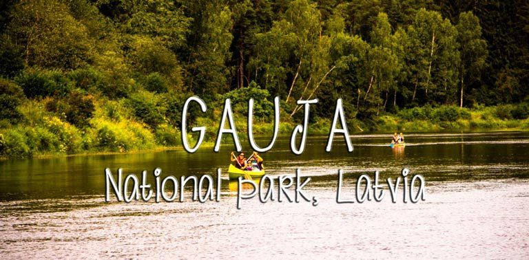
Hiking in Gauja National Park, Latvia
Gauja National Park, established in 1973, is the oldest and largest national park in Latvia. It stretches over more than 90,000 hectares, protecting the most beautiful section of the Gauja Valley along the Gauja River between Valmiera and Murjani. The area is characterized by great biological diversity, variety of landform, natural springs, sandstone outcrops, picturesque views and unique natural, cultural and historical monuments.
There is a wide network of trails with several interesting starting points and huge amount of both natural wonders, like cliffs and caves, and historical monuments spread around the park area. So the first thing to do is to decide where to stay and how to hike; just some short day trips or maybe a 5-day hiking trip through the whole national park? We ended up with just one long hiking day this time, and decided to stay in a camping area close to the medieval town of Cesis, which is a sight as itself.
Camping in Gauja
Camping Ozolkans surprised us right when arriving; it is located next to the banks of the Gauja river, but also at the base of a ski slope! We had absolutely no idea that there would be any slopes in the area, since it is relative flat everywhere in Latvia, but it seems that when utilizing the high river banks, it’s doable to build ski slopes with lifts and all. Anyway, the camping place there is fine, nothing fancy and no cooking facilities other than campfires, but showers are okay, and there is hot water. One disadvantage though; there were lot of ravenous horseflies everywhere this time of the year (August), brrr.
Hike from Cesis to Ligtne
We hit the trails right from the camping site, and set the destination to Ligatne, a small town south-west of Cesis. Learned from internet that there are no way markings for this route, but that there should be paths and dirt roads going quite close to the Gauja river between the villages (the official hiking route is mostly following the actual roads, not the paths, so we didn’t want to follow that).
Forest paths next to the river were mostly easy to walk, but in some places there were a lot of fallen trees, some thickets to break through and even a couple of long time ago collapsed bridges. Hiking boots proved to be the right choice, whit just sneakers or walking sandals it would have been pretty uncomfortable hike. At times we needed to navigate a bit with a map application and GPS to find the correct way trough the forest, and it is not recommended to go without those or a decent map to this route.
On the way to Ligatne there were really nice river landscapes with groups of canoeists silently sliding down the river; would have been nice to try that as well! We didn’t actually see anyone else hiking during the day, which was bit of a surprise. Probably the crowds are then in other parts of the national park and on the marked trails. By the way, not that far from Cesis we run into a theme park with camels, lamas and alpacas! Just walked by, but had a chance to take a look at the animals that where in the outdoor area. The place is called Camel Park Raksi, if you would be interested.
We had a break and some packed lunch by the bridge crossing river Amata, and then walked through the quiet village of Skalupe. There we found out, that there were no bus connections towards Cesis anymore in the late afternoon, so we continued along paths through the forest to the edge of town Ligatne by the river. We had some luck; there was a bus just about to leave towards Augsligatne right next to the highway. So we jumped in (fare was 0,8 €), and out in Augsligatne, that is basically a station village for Ligatne. There we had some time to enjoy strawberries and well-earned beers before taking another bus back to Cesis (fare 1,4 €). Then there was still 5 kilometers to walk back to our campsite. Total distance for our hike was 28 kilometers, which was just enough for one day.
Some tips for your trip to Gauja:
a local map or a map application and GPS device, and a phone for emergencies is needed
wear proper hiking boots, as part of the forest paths are muddy and there are some stream crossings
dress up by weather, long sleeves in backpack won’t harm but might become necessary at least when taking a break
carry a lot of water with you, especially if it’s sunny, and take some easy-to-carry food, like fruits, nuts and cookies to keep energy levels up
check local transportation timetables beforehand, there is not that regular service between the villages
keep some basic first aid supplies with you just in case
insect repellent may be needed also, though it seems that it’s not helping with the horseflies 😀
